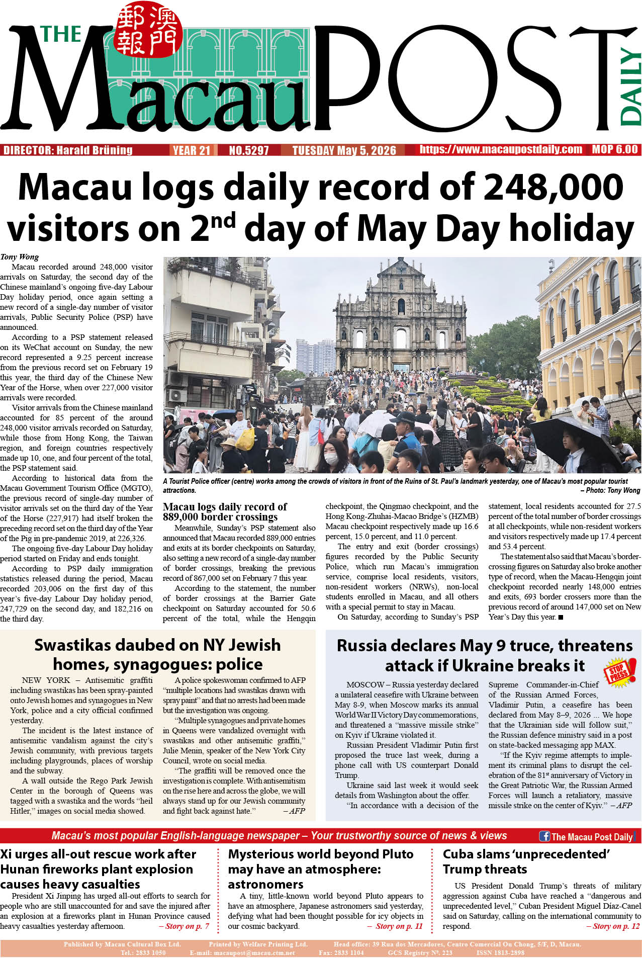
The probability of hoisting Tropical Cyclone Signal No. 8 tonight is “relatively high,” the Macau Meteorological and Geophysical Bureau (SMG) said this morning.
According to the bureau’s website, while the circulation of Tropical Cyclone “Tapah” is relatively small, the current forecast track indicates that “Tapah” will pass within 150 km southwest of Macau early tomorrow. Therefore, the observatory stated that the probability of hoisting Tropical Cyclone Signal No. 8 tonight is “relatively high.”
In addition, due to an astronomical tide in the next few days and the potential for storm surge, flooding may occur in the Inner Harbour area of the Macau Peninsula, reaching 0.5 metres or above during the daytime tomorrow. Consequently, the probability of issuing the Yellow Storm Surge warning between 2 p.m. and 5 p.m. today was “high.” According to the bureau, “Tapah,” located in the northern part of the South China Sea, is forecast to move north to north-westward and gradually strengthen, heading towards the western coast of Guangdong Province.
For the time being, the bureau has indicated that the Strong Storm Signal No. 3 will remain in effect.
The observatory predicted that temperatures will range between 25 °C and 32 °C, with relative humidity between 65 per cent and 98 per cent. The maximum UV index was expected to be “very high,” at 9 out of 10.
At 12 p.m., “Tapah” was about 380 km south-southeast of Macau (near 18.8°N, 114.3°E). It was forecast to move north-northwest at around 15 km/h towards the western coast of Guangdong, the bureau said.
The hoisting of the Tropical Cyclone Signal No.8 means that winds with a sustained speed of 63 to 117 km/h are expected or blowing, while gusts may exceed 180 km/h in Macau. Signal No.8 is Macau's third highest, five-leavel tropical cyclone warning system (1, 3, 8, 9, 10).