The local observatory announced on its website last night that Tropical Storm “Mitag” was moving north-westwards towards the coastal area of eastern Guangdong and gradually strengthening, being expected to enter within 200 kilometres of Macau during today, with a high probability of issuing Strong Wind Signal No.3 (T3) between 5 a.m. and 8 a.m.
Standby Signal No.1 was issued at midnight on September 18.
The statement said that due to Mitag’s relatively small circulation and uncertainties regarding its intensity and path, it is “possible that it will take a path which is closer to Macau than expected”, noting that the possibility of issuing a higher tropical cyclone “cannot be ruled out”.
The risk of flooding due to a storm surge is considered low, the statement said. However, Macau is expected to experience more thundery showers with strengthening winds today, it said. During the weekend, frequent heavy showers and thunderstorms accompanied by gusts can be expected, the statement said. Low-lying areas may also experience flooding due to short periods of heavy rain.
Meanwhile, Tropical Cyclone Ragasa is forecast to enter the South China Sea between this weekend and early next week.
The Hong Kong Observatory noted that Ragasa (“Onslaught” in Tagalog) is predicted to “intensify significantly and move towards the vicinity of Luzon Strait in the next few days, and it may reach super typhoon intensity. It will enter the northern part of the South China Sea early next week, and then edge closer to the coast of southern China”.
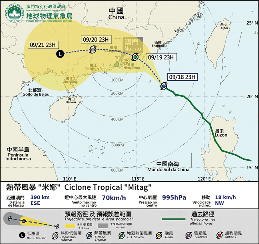
This map downloaded from the SMG website last night shows that by 11 p.m., Tropical Storm Mitag was estimated to be about 390km east-southeast of Macau. It was forecast to move northwest at around 18km/h towards the eastern coast of Guangdong.