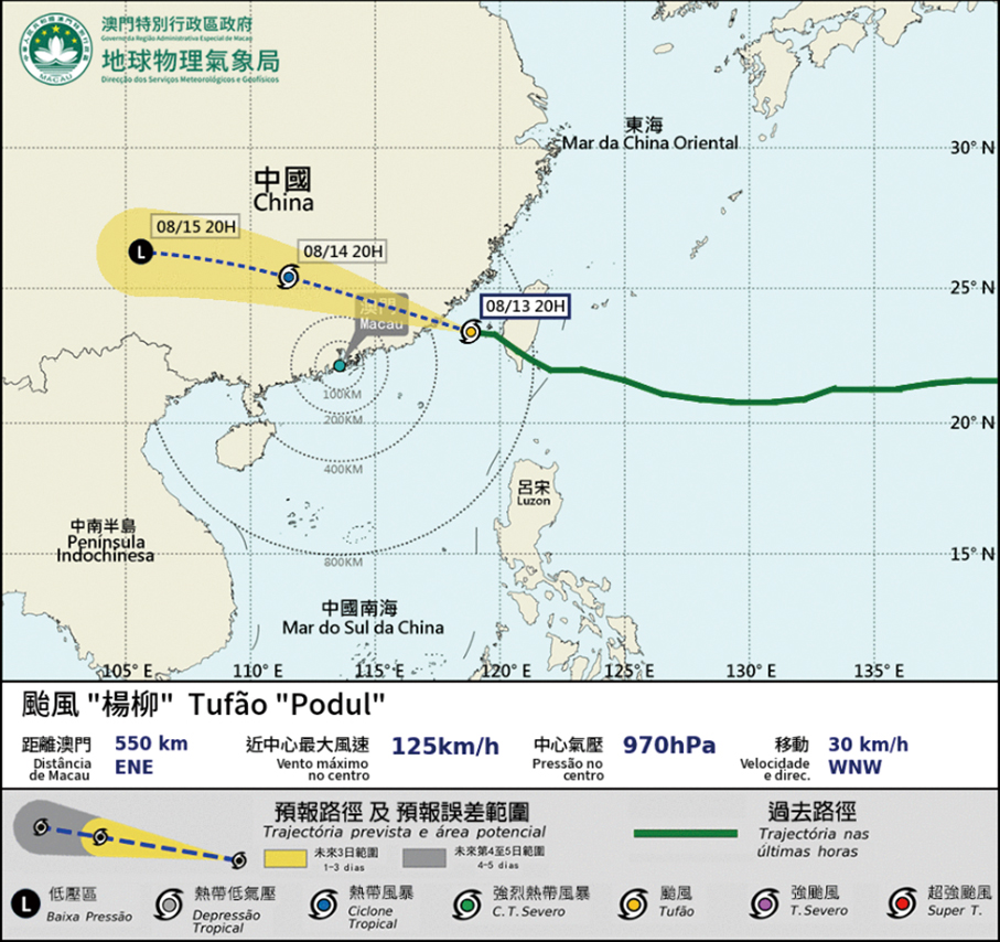
The Meteorological and Geophysical Bureau (SMG) said on its website last night that there was only a “relatively low to medium” probability for the Strong Wind Signal No.3 to be hoisted today.
The bureau hoisted the Standby Signal No.1 at 12 p.m. yesterday and said that at that time Typhoon “Podul” (which in Korean means “Willow”) was about 870 kilometres from Macau in the South China Sea.
According to the observatory, at 8 p.m. yesterday, “Podul” was estimated to be about 550 kilometres from Macau.
Depending on its location and strength, Macau’s weather station classifies a tropical cyclone into tropical depression, tropical storm, strong tropical storm, typhoon, severe typhoon, and super typhoon.
Signal No.1 is the lowest of Macau’s tropical cyclone warning signals. It is hoisted when a tropical cyclone comes within 800 kilometres from Macau. Its higher warning typhoon signals are the No.3, No.8, No.9, and No.10.
The bureau said last night that the tropical cyclone was predicted to move northwest west, after which it was forecast to approach eastern Guangdong Province and southern Fujian Province today, when the tropical cyclone’s rain cloud was expected to result in frequent heavy showers and thunderstorms, with strong gusts from today to early tomorrow. Low-lying areas may flood due to short-term heavy rainfall.
Consequently, the website said, the bureau concluded that there was a “relatively low” probability that it would need to hoist the Strong Wind Signal No.3 today.

This handout photo provided by the Macau Meteorological and Geophysical Bureau (SMG) yesterday shows Typhoon “Podul” moving in the South China Sea towards eastern Guangdong Province and southern Fujian Province.


